
Thank you for supporting this site ❤️
Make a donation
Make a donation
Gear up for your next adventure:
As an Amazon Associate, this site earns from qualifying purchases at no extra cost to you.
Viñuela topographic map
Click on the map to display elevation.
Thank you for supporting this site ❤️
Make a donation
Make a donation
Gear up for your next adventure:
As an Amazon Associate, this site earns from qualifying purchases at no extra cost to you.
About this map
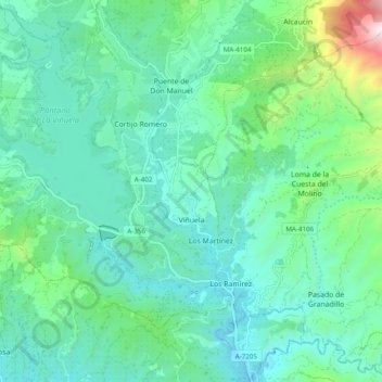
Name: Viñuela topographic map, elevation, terrain.
Location: Viñuela, La Axarquía, Malaga, Andalusia, Spain (36.82911 -4.20887 36.90690 -4.11216)
Average elevation: 1,024 ft
Minimum elevation: 207 ft
Maximum elevation: 4,341 ft
Thank you for supporting this site ❤️
Make a donation
Make a donation
Gear up for your next adventure:
As an Amazon Associate, this site earns from qualifying purchases at no extra cost to you.