
Thank you for supporting this site ❤️
Make a donation
Make a donation
Gear up for your next adventure:
As an Amazon Associate, this site earns from qualifying purchases at no extra cost to you.
Ha-Foso topographic map
Click on the map to display elevation.
Thank you for supporting this site ❤️
Make a donation
Make a donation
Gear up for your next adventure:
As an Amazon Associate, this site earns from qualifying purchases at no extra cost to you.
About this map
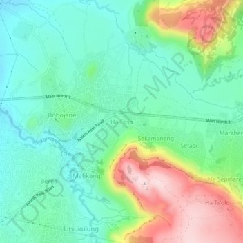
Name: Ha-Foso topographic map, elevation, terrain.
Location: Ha-Foso, Berea District, 75038, Lesotho (-29.28858 27.55405 -29.24858 27.59405)
Average elevation: 5,230 ft
Minimum elevation: 4,895 ft
Maximum elevation: 5,951 ft
Thank you for supporting this site ❤️
Make a donation
Make a donation
Gear up for your next adventure:
As an Amazon Associate, this site earns from qualifying purchases at no extra cost to you.