Geolocate

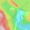
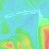
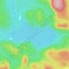
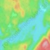
Lac Alice topographic map

Click on the map to display elevation.

About this map

Name: Lac Alice topographic map, elevation, terrain.

Location: Lac Alice, Rivière-aux-Outardes, Manicouagan, Côte-Nord, Québec, Canada (49.69139 -68.76957 49.70578 -68.75371)

Average elevation: 1,030 ft

Minimum elevation: 928 ft

Maximum elevation: 1,470 ft

Other topographic maps

Click on a map to view its topography, its elevation and its terrain.

Monts-Groulx

Canada > Québec > Manicouagan > Rivière-aux-Outardes

Average elevation: 3,235 ft

Manic 5.

Canada > Québec > Manicouagan > Rivière-aux-Outardes

Average elevation: 1,145 ft

Lac Varin

Canada > Québec > Manicouagan > Rivière-aux-Outardes

Average elevation: 1,266 ft

Lac Louise

Canada > Québec > Manicouagan > Rivière-aux-Outardes

Average elevation: 1,385 ft

Lac Donlon

Canada > Québec > Manicouagan > Rivière-aux-Outardes

Average elevation: 755 ft

Lac Boston

Canada > Québec > Manicouagan > Rivière-aux-Outardes

Average elevation: 1,227 ft

Lac Porc

Canada > Québec > Manicouagan > Rivière-aux-Outardes

Average elevation: 1,142 ft

Lac Beaudry

Canada > Québec > Manicouagan > Rivière-aux-Outardes

Average elevation: 1,427 ft

Lac Després

Canada > Québec > Manicouagan > Rivière-aux-Outardes

Average elevation: 1,230 ft

Lac du Centre

Canada > Québec > Manicouagan > Rivière-aux-Outardes

Average elevation: 1,280 ft

Gear up for your next adventure:

🪑Portable Camp Table - Compact table for campsite meals
🧭Hiking Compass - Precision compass for reliable navigation in the wilderness
🛠️Backpacking Tool Kit - Essential toolkit for outdoor repairs
💧Water Purification System - Clean water on the trail with reliable purifiers
📡GPS Antenna Upgrade - Enhance GPS reception in remote terrain

As an Amazon Associate, this site earns from qualifying purchases at no extra cost to you.