
Thank you for supporting this site ❤️
Make a donation
Make a donation
Gear up for your next adventure:
As an Amazon Associate, this site earns from qualifying purchases at no extra cost to you.
Karjan Taluka topographic map
Click on the map to display elevation.
Thank you for supporting this site ❤️
Make a donation
Make a donation
Gear up for your next adventure:
As an Amazon Associate, this site earns from qualifying purchases at no extra cost to you.
About this map
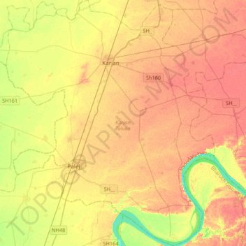
Name: Karjan Taluka topographic map, elevation, terrain.
Location: Karjan Taluka, Vadodara District, Gujarat, India (21.82247 72.98510 22.12757 73.26449)
Average elevation: 85 ft
Minimum elevation: -3 ft
Maximum elevation: 131 ft
Thank you for supporting this site ❤️
Make a donation
Make a donation
Gear up for your next adventure:
As an Amazon Associate, this site earns from qualifying purchases at no extra cost to you.