Geolocate

Bièvre topographic map

Click on the map to display elevation.

About this map

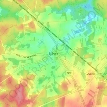
Name: Bièvre topographic map, elevation, terrain.

Location: Bièvre, Dinant, Namur, Wallonie, 5555, Belgique (49.92112 4.99685 49.96112 5.03685)

Average elevation: 1,276 ft

Minimum elevation: 1,145 ft

Maximum elevation: 1,424 ft

Gear up for your next adventure:

🧼Biodegradable Camping Soap - Eco‑friendly soap for outdoor hygiene
🧦Hiking Socks - Comfortable socks to prevent blisters on long hikes
🪶LED Camping Lantern - Bright lantern for camp lighting
🥩Freeze-Dried Meals - Nutritious and lightweight food for remote expeditions
📷Action Camera - Capture your outdoor adventures in HD

As an Amazon Associate, this site earns from qualifying purchases at no extra cost to you.