
Make a donation
Gear up for your next adventure:
As an Amazon Associate, this site earns from qualifying purchases at no extra cost to you.
Sentruper Höhe topographic map
Click on the map to display elevation.
Make a donation
Gear up for your next adventure:
As an Amazon Associate, this site earns from qualifying purchases at no extra cost to you.
Sentruper Höhe
Sentrup beziehungsweise nach der Hauptsatzung Sentruper Höhe ist ein Wohnbereich (Stadtteil) von Münster in Westfalen (Bundesrepublik Deutschland). Er liegt zwischen der Innenstadt und südöstlich von Gievenbeck im Westen Münsters. Sentrup ist dem Stadtbezirk West zugeordnet. Die offizielle Einwohnerzahl betrug zum 31. Dezember 2017 7676 Einwohner auf einer Fläche von circa 6,6 km². Aufgrund des relativ zentralen Standortes und der Nähe zu diversen Naherholungsgebieten zählt die Sentruper Höhe zu Münsters begehrtesten und teuersten Wohnlagen.
Make a donation
Gear up for your next adventure:
As an Amazon Associate, this site earns from qualifying purchases at no extra cost to you.
About this map
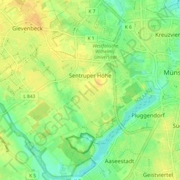
Name: Sentruper Höhe topographic map, elevation, terrain.
Average elevation: 217 ft
Minimum elevation: 171 ft
Maximum elevation: 256 ft
Make a donation
Gear up for your next adventure:
As an Amazon Associate, this site earns from qualifying purchases at no extra cost to you.
Other topographic maps
Click on a map to view its topography, its elevation and its terrain.
Aasee
Deutschland > Nordrhein-Westfalen > Münster
Heute ist der See Kernstück eines beliebten Naherholungsziels nahe dem Stadtzentrum. Am Aasee angesiedelt sind eine Jugendherberge, mehrere Studentenwohnheime, die Mensa am Aasee, der Sportpark Sentruper Höhe, der Allwetterzoo Münster mit dem Westfälischen Pferdemuseum Münster, das LWL-Museum für…
Average elevation: 213 ft
Make a donation
Gear up for your next adventure:
As an Amazon Associate, this site earns from qualifying purchases at no extra cost to you.