Geolocate

Candelaria topographic map

Click on the map to display elevation.

About this map

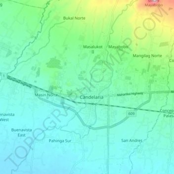
Name: Candelaria topographic map, elevation, terrain.

Location: Candelaria, Quezon, Calabarzon, 4323, Philippines (13.89347 121.38249 13.97347 121.46249)

Average elevation: 276 ft

Minimum elevation: 79 ft

Maximum elevation: 1,083 ft

Gear up for your next adventure:

🏔️Mountain Trail Maps - High‑detail maps for popular peaks
🧯Emergency Survival Kit - All‑in‑one survival essentials for the backcountry
Backpacking Tents - Weight-optimized shelters for multi-day topographic surveys
🥾Women's Hiking Boots - Top-rated trail boots with ankle support and superior grip
🪶Compact Camp Shovel - Folding shovel for campsite tasks

As an Amazon Associate, this site earns from qualifying purchases at no extra cost to you.