
Clervaux topographic map
Interactive map
Click on the map to display elevation.
About this map
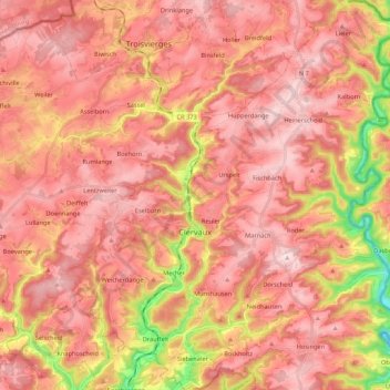
Name: Clervaux topographic map, elevation, terrain.
Location: Clervaux, Canton Clervaux, Luxembourg (49.99886 5.95692 50.13657 6.13796)
Average elevation: 1,480 ft
Minimum elevation: 833 ft
Maximum elevation: 1,791 ft
Other topographic maps
Click on a map to view its topography, its elevation and its terrain.
Lieler
Luxembourg > Canton Clervaux > Clervaux
Lieler, Clervaux, Canton Clervaux, 9972, Luxembourg
Average elevation: 1,470 ft