
Thank you for supporting this site ❤️
Make a donation
Make a donation
Gear up for your next adventure:
As an Amazon Associate, this site earns from qualifying purchases at no extra cost to you.
Wahnsdorf topographic map
Click on the map to display elevation.
Thank you for supporting this site ❤️
Make a donation
Make a donation
Gear up for your next adventure:
As an Amazon Associate, this site earns from qualifying purchases at no extra cost to you.
About this map
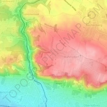
Name: Wahnsdorf topographic map, elevation, terrain.
Location: Wahnsdorf, Radebeul, Meißen, Sachsen, Deutschland (51.11095 13.65326 51.12837 13.69310)
Average elevation: 623 ft
Minimum elevation: 371 ft
Maximum elevation: 817 ft
Thank you for supporting this site ❤️
Make a donation
Make a donation
Gear up for your next adventure:
As an Amazon Associate, this site earns from qualifying purchases at no extra cost to you.