Geolocate

Bellvale topographic map

Click on the map to display elevation.

About this map

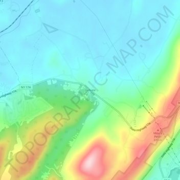
Name: Bellvale topographic map, elevation, terrain.

Location: Bellvale, Town of Warwick, Orange County, New York, 10912, United States (41.23037 -74.33071 41.27037 -74.29071)

Average elevation: 741 ft

Minimum elevation: 505 ft

Maximum elevation: 1,358 ft

Orange County trails, hiking, mountain biking, running and outdoor activities

Other topographic maps

Click on a map to view its topography, its elevation and its terrain.

Gear up for your next adventure:

🥾Men's Hiking Boots - Durable, waterproof footwear for rugged terrain and steep inclines
📡GPS Antenna Upgrade - Enhance GPS reception in remote terrain
📶Satellite Messenger - Communication device off‑grid
🦟Ultrasonic Repellers - Create a bug-free zone at your camp or rest stop
🏕️Family Camping Gear - Essentials for group camping trips

As an Amazon Associate, this site earns from qualifying purchases at no extra cost to you.