
Make a donation
Gear up for your next adventure:
As an Amazon Associate, this site earns from qualifying purchases at no extra cost to you.
Fall Creek Falls State Park topographic map
Click on the map to display elevation.
Make a donation
Gear up for your next adventure:
As an Amazon Associate, this site earns from qualifying purchases at no extra cost to you.
Fall Creek Falls State Park
Just beyond its source, Cane Creek slowly gains strength as it absorbs Meadow Creek and several smaller streams. As the creek enters the gorge, it drops several hundred feet in less than a mile, including 45 feet (14 m) over Cane Creek Cascades and 85 feet (26 m) over Cane Creek Falls. A few hundred meters north of Cane Creek Falls, Rockhouse Creek spills 125 feet (38 m) over a plunge waterfall. Over the next half-mile, Cane Creek absorbs Fall Creek and Piney Creek, both of which enter from smaller gorges to the immediate west. During this stretch, part of the creek disappears underground into limestone sinks and reemerges at a spring known as "Crusher Hole." Cane Creek continues to lose elevation before steadying near its confluence with Dry Fork. Beyond Dry Fork, the creek gradually descends to the Highland Rim, where it empties into the Caney Fork River.
Make a donation
Gear up for your next adventure:
As an Amazon Associate, this site earns from qualifying purchases at no extra cost to you.
About this map
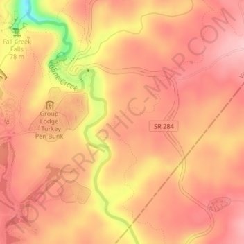
Name: Fall Creek Falls State Park topographic map, elevation, terrain.
Average elevation: 1,719 ft
Minimum elevation: 1,355 ft
Maximum elevation: 1,850 ft
Van Buren County trails, hiking, mountain biking, running and outdoor activities
Make a donation
Gear up for your next adventure:
As an Amazon Associate, this site earns from qualifying purchases at no extra cost to you.