Geolocate

Deomali topographic map

Click on the map to display elevation.

About this map

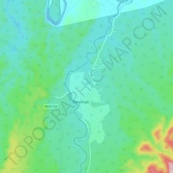
Name: Deomali topographic map, elevation, terrain.

Location: Deomali, Namsang, Tirap, Arunachal Pradesh, India (27.15592 95.42424 27.23592 95.50424)

Average elevation: 614 ft

Minimum elevation: 387 ft

Maximum elevation: 1,732 ft

Gear up for your next adventure:

🥤Water Filter Bottle - All‑in‑one filter bottle for safe hydration
🗺️Topographic Maps - Detailed topo maps for hiking, exploring and outdoor navigation
🧦Hiking Socks - Comfortable socks to prevent blisters on long hikes
Backpacking Tent - Lightweight and durable tent for multi‑day hikes
🍳Camping Cook Set - Complete cookware for outdoor meals

As an Amazon Associate, this site earns from qualifying purchases at no extra cost to you.