
Sessa Orchid Sanctuary topographic map
Interactive map
Click on the map to display elevation.
About this map
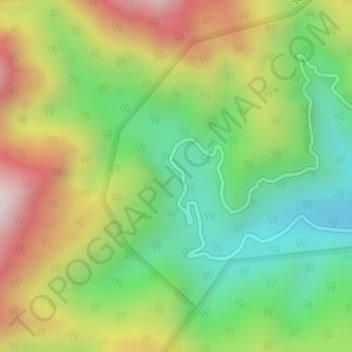
Name: Sessa Orchid Sanctuary topographic map, elevation, terrain.
Average elevation: 4,639 ft
Minimum elevation: 3,176 ft
Maximum elevation: 6,706 ft
Sessa sanctuary is drained by the Tippi Naala (Tippi river), which joins the Kameng river at Tippi village on the Bhalukpong-Bomdila highway. Topographic map
Other topographic maps
Click on a map to view its topography, its elevation and its terrain.
Bhalukpong
India > Arunachal Pradesh > Bhalukpong EAC
Bhalukpong, Bhalukpong EAC, West Kameng District, Arunachal Pradesh, 790114, India
Average elevation: 797 ft
Eagle Nest WLS
India > Arunachal Pradesh > Bhalukpong EAC
Eagle Nest WLS, Bhalukpong EAC, West Kameng district, Arunachal Pradesh, India
Average elevation: 5,512 ft