
Thank you for supporting this site ❤️
Make a donation
Make a donation
Gear up for your next adventure:
As an Amazon Associate, this site earns from qualifying purchases at no extra cost to you.
Oelsig topographic map
Click on the map to display elevation.
Thank you for supporting this site ❤️
Make a donation
Make a donation
Gear up for your next adventure:
As an Amazon Associate, this site earns from qualifying purchases at no extra cost to you.
About this map
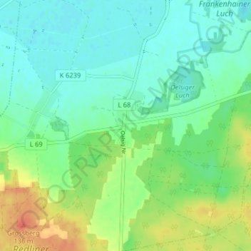
Name: Oelsig topographic map, elevation, terrain.
Location: Oelsig, Schlieben, Elbe-Elster, Brandenburg, Deutschland (51.66361 13.35419 51.70361 13.39419)
Average elevation: 318 ft
Minimum elevation: 266 ft
Maximum elevation: 423 ft
Thank you for supporting this site ❤️
Make a donation
Make a donation
Gear up for your next adventure:
As an Amazon Associate, this site earns from qualifying purchases at no extra cost to you.