Geolocate

Surallah topographic map

Click on the map to display elevation.

About this map

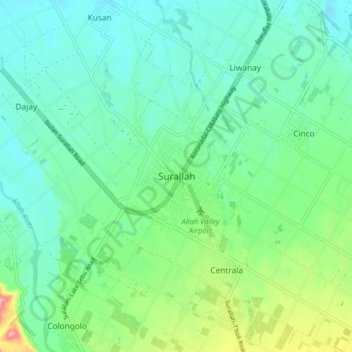
Name: Surallah topographic map, elevation, terrain.

Location: Surallah, South Cotabato, Soccsksargen, 9512, Philippines (6.33561 124.70725 6.41561 124.78725)

Average elevation: 617 ft

Minimum elevation: 505 ft

Maximum elevation: 955 ft

Gear up for your next adventure:

🦶Carbon Trekking Poles - Reduce knee impact on steep descents with ultra-light poles
🪄Magnetic Compass - Accurate compass for navigation
🔋Solar Power Banks - Keep your GPS and phone charged in remote wilderness areas
🧭GPS Watch Accessories - Bands and chargers for GPS watches
📚Navigation Handbooks - Master the art of reading topographic maps and using a compass

As an Amazon Associate, this site earns from qualifying purchases at no extra cost to you.