Geolocate

Capaci topographic map

Click on the map to display elevation.

About this map

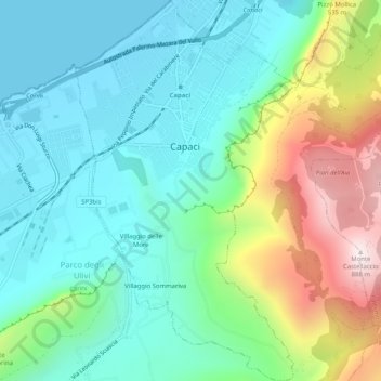
Name: Capaci topographic map, elevation, terrain.

Location: Capaci, Palermo, Sicily, 90040, Italy (38.14614 13.22445 38.18600 13.25427)

Average elevation: 732 ft

Minimum elevation: 0 ft

Maximum elevation: 2,900 ft

Gear up for your next adventure:

🧢Outdoor Hiking Hat - Sun protection hat for outdoor explorers
🩳Quick‑Dry Hiking Shorts - Comfortable and quick‑dry shorts for summer hiking
GPS Sports Watch - GPS watch for running, hiking and training
🧭Pro Hiking Compasses - High-accuracy liquid-filled compasses for topographic orientation
Backpacking Tent - Lightweight and durable tent for multi‑day hikes

As an Amazon Associate, this site earns from qualifying purchases at no extra cost to you.