
Thank you for supporting this site ❤️
Make a donation
Make a donation
Gear up for your next adventure:
As an Amazon Associate, this site earns from qualifying purchases at no extra cost to you.
Bonfol topographic map
Click on the map to display elevation.
Thank you for supporting this site ❤️
Make a donation
Make a donation
Gear up for your next adventure:
As an Amazon Associate, this site earns from qualifying purchases at no extra cost to you.
About this map
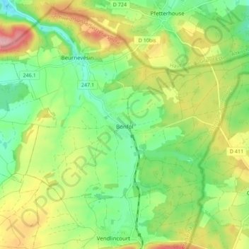
Name: Bonfol topographic map, elevation, terrain.
Location: Bonfol, District de Porrentruy, Jura, 2944, Suisse (47.46006 7.11892 47.49428 7.20296)
Average elevation: 1,516 ft
Minimum elevation: 1,332 ft
Maximum elevation: 1,785 ft
Thank you for supporting this site ❤️
Make a donation
Make a donation
Gear up for your next adventure:
As an Amazon Associate, this site earns from qualifying purchases at no extra cost to you.