
Thank you for supporting this site ❤️
Make a donation
Make a donation
Gear up for your next adventure:
As an Amazon Associate, this site earns from qualifying purchases at no extra cost to you.
Kenilworth topographic map
Click on the map to display elevation.
Thank you for supporting this site ❤️
Make a donation
Make a donation
Gear up for your next adventure:
As an Amazon Associate, this site earns from qualifying purchases at no extra cost to you.
About this map
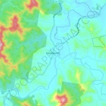
Name: Kenilworth topographic map, elevation, terrain.
Location: Kenilworth, Sunshine Coast, Queensland, 4574, Australia (-26.63535 152.68726 -26.55535 152.76726)
Average elevation: 522 ft
Minimum elevation: 259 ft
Maximum elevation: 1,585 ft
Thank you for supporting this site ❤️
Make a donation
Make a donation
Gear up for your next adventure:
As an Amazon Associate, this site earns from qualifying purchases at no extra cost to you.