
Make a donation
Gear up for your next adventure:
As an Amazon Associate, this site earns from qualifying purchases at no extra cost to you.
Sint-Jansberg topographic map
Click on the map to display elevation.
Make a donation
Gear up for your next adventure:
As an Amazon Associate, this site earns from qualifying purchases at no extra cost to you.
Sint-Jansberg
De Nederrijnse Heuvelrug (Duits: Niederrheinischer Höhenzug) is een stuwwal, die zich met verschillende onderbrekingen in het westen van het Nederrijnse Laagvlakte van Krefeld tot Nijmegen in een wijde boog tussen het Rijndal in het oosten en het dal van de Niers uitstrekt. Dit landschapelement wordt ook wel de Nederrijnse Hoogte genoemd.
Make a donation
Gear up for your next adventure:
As an Amazon Associate, this site earns from qualifying purchases at no extra cost to you.
About this map
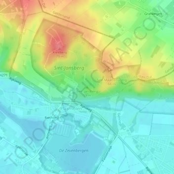
Name: Sint-Jansberg topographic map, elevation, terrain.
Average elevation: 98 ft
Minimum elevation: 20 ft
Maximum elevation: 249 ft
Make a donation
Gear up for your next adventure:
As an Amazon Associate, this site earns from qualifying purchases at no extra cost to you.