Geolocate

Jaijon topographic map

Click on the map to display elevation.

About this map

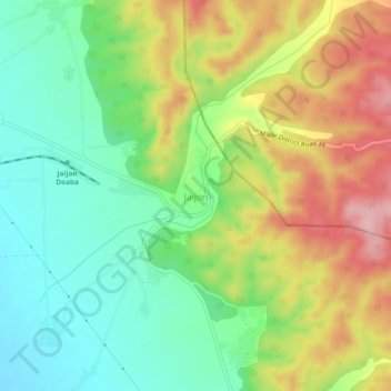
Name: Jaijon topographic map, elevation, terrain.

Location: Jaijon, Garhshankar Tahsil, Hoshiarpur, Punjab, 144530, India (31.32651 76.12894 31.36651 76.16894)

Average elevation: 1,316 ft

Minimum elevation: 1,076 ft

Maximum elevation: 1,654 ft

Gear up for your next adventure:

🔋Solar Power Banks - Keep your GPS and phone charged in remote wilderness areas
🦶Carbon Trekking Poles - Reduce knee impact on steep descents with ultra-light poles
🪑Ultralight Camp Chairs - Portable seating for resting after a long day of mapping
🎒Outdoor Daypacks - Lightweight backpacks designed for carrying maps and essential gear
🎒Gear Packing Cubes - Organize your backpack efficiently

As an Amazon Associate, this site earns from qualifying purchases at no extra cost to you.