Geolocate

Udma topographic map

Click on the map to display elevation.

About this map

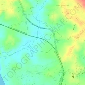
Name: Udma topographic map, elevation, terrain.

Location: Udma, Uduma, Hosdurg, Kasaragod district, Kerala, India (12.44334 75.01090 12.45637 75.02813)

Average elevation: 85 ft

Minimum elevation: -3 ft

Maximum elevation: 207 ft

Gear up for your next adventure:

📖Nature Tracking Books - Learn to track wildlife and terrain
🥩Freeze-Dried Meals - Nutritious and lightweight food for remote expeditions
📱Solar Portable Charger - Solar power bank for charging devices off‑grid
📱Heavy-Duty Phone Cases - Drop-proof and waterproof protection for outdoor navigation
🥾Hiking Shoes - Durable and comfortable shoes for trail hiking

As an Amazon Associate, this site earns from qualifying purchases at no extra cost to you.