
Ellendale topographic map
Click on the map to display elevation.
Ellendale
Originally, the River des Peres ran through the neighborhood, from its underground beginnings in Forest Park. It was converted to a drainage project, and now all that remains is the valley created by it. This valley forms the main topographical characteristic of the neighborhood.
About this map
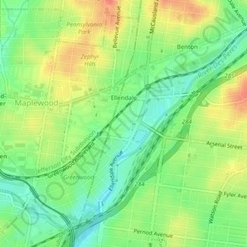
Name: Ellendale topographic map, elevation, terrain.
Location: Ellendale, Saint Louis, Missouri, United States (38.59806 -90.31908 38.62243 -90.28803)
Average elevation: 495 ft
Minimum elevation: 413 ft
Maximum elevation: 594 ft
Missouri trails, hiking, mountain biking, running and outdoor activities