
Make a donation
Gear up for your next adventure:
As an Amazon Associate, this site earns from qualifying purchases at no extra cost to you.
Blue Eye, MO topographic map
Click on the map to display elevation.
Make a donation
Gear up for your next adventure:
As an Amazon Associate, this site earns from qualifying purchases at no extra cost to you.
About this map
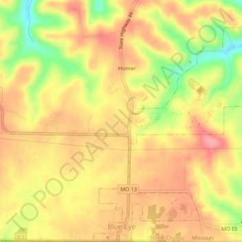
Name: Blue Eye, MO topographic map, elevation, terrain.
Location: Blue Eye, MO, Stone County, Missouri, United States (36.49866 -93.40135 36.52962 -93.36840)
Average elevation: 1,253 ft
Minimum elevation: 1,047 ft
Maximum elevation: 1,378 ft
Stone County trails, hiking, mountain biking, running and outdoor activities
Make a donation
Gear up for your next adventure:
As an Amazon Associate, this site earns from qualifying purchases at no extra cost to you.
Other topographic maps
Click on a map to view its topography, its elevation and its terrain.
Make a donation
Gear up for your next adventure:
As an Amazon Associate, this site earns from qualifying purchases at no extra cost to you.