
Luxemburg topographic map
Interactive map
Click on the map to display elevation.
About this map
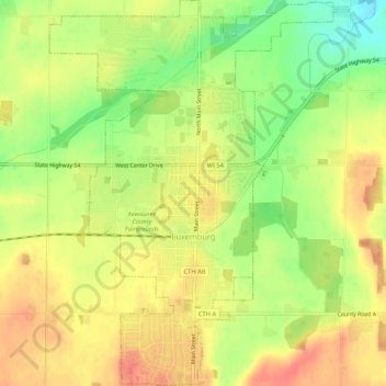
Name: Luxemburg topographic map, elevation, terrain.
Location: Luxemburg, Kewaunee County, Wisconsin, 54217, United States (44.52361 -87.72369 44.56134 -87.68254)
Average elevation: 794 ft
Minimum elevation: 689 ft
Maximum elevation: 869 ft
Kewaunee County trails, hiking, mountain biking, running and outdoor activities
Other topographic maps
Click on a map to view its topography, its elevation and its terrain.