Geolocate

Keithhall topographic map

Click on the map to display elevation.

About this map

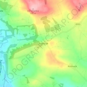
Name: Keithhall topographic map, elevation, terrain.

Location: Keithhall, Aberdeenshire, Scotland, AB51 0LW, United Kingdom (57.25936 -2.34816 57.29936 -2.30816)

Average elevation: 348 ft

Minimum elevation: 157 ft

Maximum elevation: 617 ft

Gear up for your next adventure:

📱Solar Portable Charger - Solar power bank for charging devices off‑grid
👟Men's Trail Runners - Lightweight footwear for fast-paced exploration and light hiking
🛰️Handheld GPS Units - Professional satellite navigators for precise backcountry mapping
🧤Hiking Gloves - Protective gloves for rugged trails
🧦Merino Wool Socks - Moisture-wicking, blister-preventing socks for long treks

As an Amazon Associate, this site earns from qualifying purchases at no extra cost to you.