Make a donation
Gear up for your next adventure:
As an Amazon Associate, this site earns from qualifying purchases at no extra cost to you.
Fressingfield topographic map
Click on the map to display elevation.
Make a donation
Gear up for your next adventure:
As an Amazon Associate, this site earns from qualifying purchases at no extra cost to you.
About this map
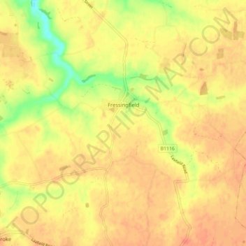
Name: Fressingfield topographic map, elevation, terrain.
Location: Fressingfield, Mid Suffolk, Suffolk, England, United Kingdom (52.31935 1.29237 52.36630 1.38008)
Average elevation: 164 ft
Minimum elevation: 69 ft
Maximum elevation: 203 ft
Make a donation
Gear up for your next adventure:
As an Amazon Associate, this site earns from qualifying purchases at no extra cost to you.
Other topographic maps
Click on a map to view its topography, its elevation and its terrain.
Stanway Green
United Kingdom > England > Suffolk > Mid Suffolk > Worlingworth
Average elevation: 190 ft
Make a donation
Gear up for your next adventure:
As an Amazon Associate, this site earns from qualifying purchases at no extra cost to you.
Make a donation
Gear up for your next adventure:
As an Amazon Associate, this site earns from qualifying purchases at no extra cost to you.
Make a donation
Gear up for your next adventure:
As an Amazon Associate, this site earns from qualifying purchases at no extra cost to you.
Make a donation
Gear up for your next adventure:
As an Amazon Associate, this site earns from qualifying purchases at no extra cost to you.
Thorpe Street
United Kingdom > England > Suffolk > Mid Suffolk > Hinderclay > Thorpe Street
Average elevation: 118 ft
Withersdale Street
United Kingdom > England > Suffolk > Mid Suffolk > Mendham > Withersdale Street
Average elevation: 125 ft
Make a donation
Gear up for your next adventure:
As an Amazon Associate, this site earns from qualifying purchases at no extra cost to you.
