Geolocate

Red Butte topographic map

Click on the map to display elevation.

About this map

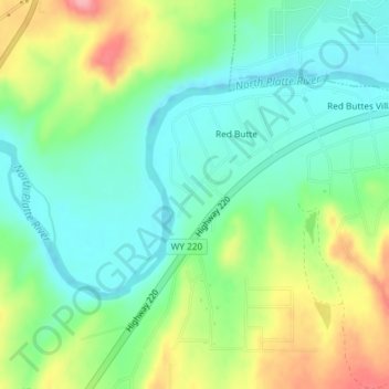
Name: Red Butte topographic map, elevation, terrain.

Location: Red Butte, Natrona County, Wyoming, United States (42.79349 -106.44494 42.81016 -106.41695)

Average elevation: 5,256 ft

Minimum elevation: 5,128 ft

Maximum elevation: 5,502 ft

Natrona County trails, hiking, mountain biking, running and outdoor activities

Other topographic maps

Click on a map to view its topography, its elevation and its terrain.

Mills

United States > Wyoming > Natrona County

Average elevation: 5,187 ft

Casper

United States > Wyoming > Natrona County > Casper

Average elevation: 5,666 ft

Casper

United States > Wyoming > Natrona County

Average elevation: 5,364 ft

Gear up for your next adventure:

📶Vehicle Signal Boosters - Improve reception in rural areas while driving to trailheads
🩳Quick‑Dry Hiking Shorts - Comfortable and quick‑dry shorts for summer hiking
🎒Waterproof Dry Bags - Keep your electronics and maps dry inside your pack
🦺Reflective Outdoor Gear - Safety gear for low‑light conditions
🪵Folding Camp Saw - Compact saw for wood and campsite work

As an Amazon Associate, this site earns from qualifying purchases at no extra cost to you.