
Thank you for supporting this site ❤️
Make a donation
Make a donation
Gear up for your next adventure:
As an Amazon Associate, this site earns from qualifying purchases at no extra cost to you.
Chamana topographic map
Click on the map to display elevation.
Thank you for supporting this site ❤️
Make a donation
Make a donation
Gear up for your next adventure:
As an Amazon Associate, this site earns from qualifying purchases at no extra cost to you.
About this map
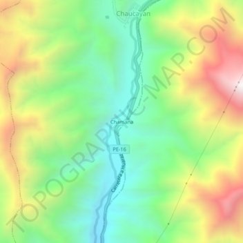
Name: Chamana topographic map, elevation, terrain.
Location: Chamana, Llacllín, Recuay, Áncash, Perú (-10.22450 -77.57732 -10.18450 -77.53732)
Average elevation: 5,272 ft
Minimum elevation: 3,730 ft
Maximum elevation: 7,644 ft
Thank you for supporting this site ❤️
Make a donation
Make a donation
Gear up for your next adventure:
As an Amazon Associate, this site earns from qualifying purchases at no extra cost to you.