Geolocate

Edale topographic map

Click on the map to display elevation.

About this map

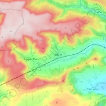
Name: Edale topographic map, elevation, terrain.

Location: Edale, High Peak, Derbyshire, East Midlands, England, United Kingdom (53.34419 -1.88541 53.39331 -1.75940)

Average elevation: 1,325 ft

Minimum elevation: 574 ft

Maximum elevation: 2,093 ft

Other topographic maps

Click on a map to view its topography, its elevation and its terrain.

Grindsbrook Booth

United Kingdom > England > Derbyshire > High Peak > Edale

Average elevation: 1,270 ft

Gear up for your next adventure:

🔊Portable Camp Speaker - Music and alerts at camp
🛌Ultralight Sleeping Bags - Compact down bags for cold nights in the wilderness
🧦Hiking Socks - Comfortable socks to prevent blisters on long hikes
🌐World Map Poster - Decorative world maps with topographic info
🪶Survival Guide Book - Expert advice for emergency preparedness

As an Amazon Associate, this site earns from qualifying purchases at no extra cost to you.