
Make a donation
Gear up for your next adventure:
As an Amazon Associate, this site earns from qualifying purchases at no extra cost to you.
Milroy topographic map
Click on the map to display elevation.
Make a donation
Gear up for your next adventure:
As an Amazon Associate, this site earns from qualifying purchases at no extra cost to you.
About this map
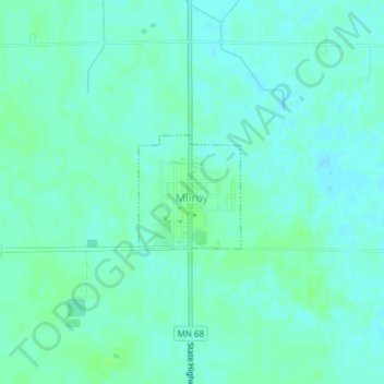
Name: Milroy topographic map, elevation, terrain.
Location: Milroy, Redwood County, Minnesota, United States (44.41400 -95.55855 44.42201 -95.54845)
Average elevation: 1,106 ft
Minimum elevation: 1,093 ft
Maximum elevation: 1,119 ft
Redwood County trails, hiking, mountain biking, running and outdoor activities
Make a donation
Gear up for your next adventure:
As an Amazon Associate, this site earns from qualifying purchases at no extra cost to you.
Other topographic maps
Click on a map to view its topography, its elevation and its terrain.
Tiger Lake WMA, Hansen, Sperl & Stancer Tracts
United States > Minnesota > Redwood County
Average elevation: 902 ft
Tiger Lake WMA, Kaufenberg, Stokke, & Vagts Tracts
United States > Minnesota > Redwood County
Average elevation: 876 ft