
Achenkirch topographic map
Interactive map
Click on the map to display elevation.
About this map
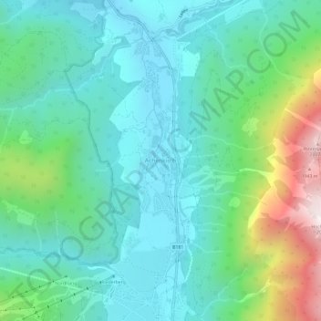
Name: Achenkirch topographic map, elevation, terrain.
Location: Achenkirch, Bezirk Schwaz, Tirol, 6215, Österreich (47.50762 11.68560 47.54762 11.72560)
Average elevation: 3,816 ft
Minimum elevation: 2,910 ft
Maximum elevation: 6,713 ft
Die komplette Liste der Statistik Austria ist in: Topographische Siedlungskennzeichnung nach STAT
Other topographic maps
Click on a map to view its topography, its elevation and its terrain.
Zemmbach
Österreich > Tirol > Achenkirch
Zemmbach, Achenkirch, Schwaz, Tirol, Österreich
Average elevation: 4,928 ft