
Zemmbach topographic map
Interactive map
Click on the map to display elevation.
About this map
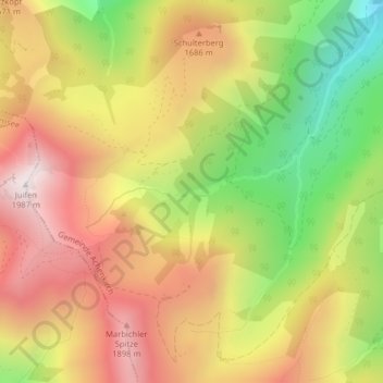
Name: Zemmbach topographic map, elevation, terrain.
Location: Zemmbach, Achenkirch, Schwaz, Tirol, Österreich (47.54034 11.63177 47.54541 11.65398)
Average elevation: 4,928 ft
Minimum elevation: 3,127 ft
Maximum elevation: 6,467 ft
Other topographic maps
Click on a map to view its topography, its elevation and its terrain.
Achenkirch
Österreich > Tirol > Achenkirch
Achenkirch, Bezirk Schwaz, Tirol, 6215, Österreich
Average elevation: 3,816 ft