
Spier topographic map
Interactive map
Click on the map to display elevation.
About this map
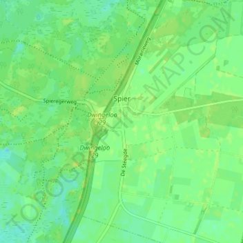
Name: Spier topographic map, elevation, terrain.
Location: Spier, Midden-Drenthe, Drenthe, Nederland (52.79589 6.45545 52.83496 6.49380)
Average elevation: 49 ft
Minimum elevation: 26 ft
Maximum elevation: 66 ft
Other topographic maps
Click on a map to view its topography, its elevation and its terrain.
VAM Berg
Nederland > Drenthe > Midden-Drenthe
VAM Berg, De Brink, Wijster, Midden-Drenthe, Drenthe, Nederland, 9418 TL, Nederland
Average elevation: 56 ft
Elp
Nederland > Drenthe > Midden-Drenthe
Elp, Midden-Drenthe, Drenthe, Nederland
Average elevation: 59 ft
Lieving
Nederland > Drenthe > Midden-Drenthe > Lieving
Lieving, Midden-Drenthe, Drenthe, Nederland, 9411, Nederland
Average elevation: 49 ft