Geolocate

Loreto topographic map

Click on the map to display elevation.

About this map

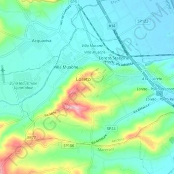
Name: Loreto topographic map, elevation, terrain.

Location: Loreto, Ancona, Marche, 60025, Italy (43.41729 13.57894 43.45632 13.65862)

Average elevation: 144 ft

Minimum elevation: -7 ft

Maximum elevation: 636 ft

Other topographic maps

Click on a map to view its topography, its elevation and its terrain.

Gabriella

Italy > Marche > Ancona > Senigallia

Average elevation: 138 ft

Gear up for your next adventure:

🛶Inflatable Kayak - Portable kayak for rivers, lakes, and expeditions
🧣Merino Neck Gaiters - Multi-functional headwear for wind and sun protection
🏕️Family Camping Gear - Essentials for group camping trips
🪶LED Camping Lantern - Bright lantern for camp lighting
🛠️Backpacking Tool Kit - Essential toolkit for outdoor repairs

As an Amazon Associate, this site earns from qualifying purchases at no extra cost to you.