
Thank you for supporting this site ❤️
Make a donation
Make a donation
Gear up for your next adventure:
As an Amazon Associate, this site earns from qualifying purchases at no extra cost to you.
Kombo topographic map
Click on the map to display elevation.
Thank you for supporting this site ❤️
Make a donation
Make a donation
Gear up for your next adventure:
As an Amazon Associate, this site earns from qualifying purchases at no extra cost to you.
About this map
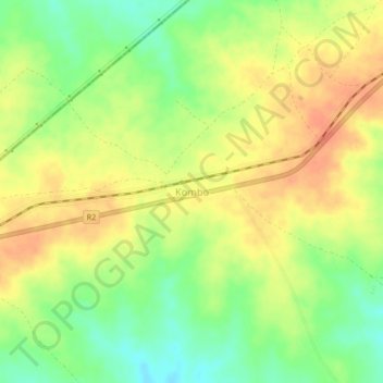
Name: Kombo topographic map, elevation, terrain.
Location: Kombo, Insiza, Matabeleland South Province, Zimbabwe (-19.86288 29.07030 -19.82288 29.11030)
Average elevation: 4,577 ft
Minimum elevation: 4,491 ft
Maximum elevation: 4,646 ft
Thank you for supporting this site ❤️
Make a donation
Make a donation
Gear up for your next adventure:
As an Amazon Associate, this site earns from qualifying purchases at no extra cost to you.