
舜耕街道 topographic map
Interactive map
Click on the map to display elevation.
About this map
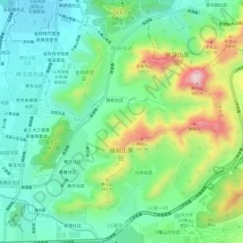
Name: 舜耕街道 topographic map, elevation, terrain.
Location: 舜耕街道, 市中区, 济南市, 山东省, 250000, 中国 (36.59702 117.00646 36.63872 117.05170)
Average elevation: 623 ft
Minimum elevation: 233 ft
Maximum elevation: 1,496 ft
Other topographic maps
Click on a map to view its topography, its elevation and its terrain.