
Thank you for supporting this site ❤️
Make a donation
Make a donation
Gear up for your next adventure:
As an Amazon Associate, this site earns from qualifying purchases at no extra cost to you.
Fahl topographic map
Click on the map to display elevation.
Thank you for supporting this site ❤️
Make a donation
Make a donation
Gear up for your next adventure:
As an Amazon Associate, this site earns from qualifying purchases at no extra cost to you.
About this map
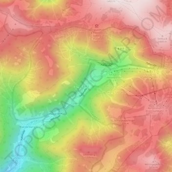
Name: Fahl topographic map, elevation, terrain.
Location: Fahl, Todtnau, Landkreis Lörrach, Baden-Württemberg, Deutschland (47.83291 7.97604 47.87291 8.01604)
Average elevation: 3,871 ft
Minimum elevation: 2,346 ft
Maximum elevation: 4,872 ft
Thank you for supporting this site ❤️
Make a donation
Make a donation
Gear up for your next adventure:
As an Amazon Associate, this site earns from qualifying purchases at no extra cost to you.