Geolocate

Up-uplas topographic map

Click on the map to display elevation.

About this map

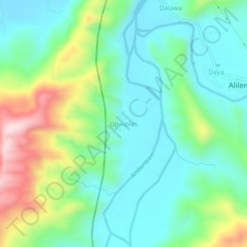
Name: Up-uplas topographic map, elevation, terrain.

Location: Up-uplas, Ilocos Sur, Ilocos Region, 2716, Philippines (16.85978 120.49102 16.89978 120.53102)

Average elevation: 472 ft

Minimum elevation: 92 ft

Maximum elevation: 1,407 ft

Gear up for your next adventure:

📡GPS Antenna Upgrade - Enhance GPS reception in remote terrain
🏕️Tent Footprint - Protect your tent base from wear
🔭Compact Binoculars - HD vision for scouting terrain and identifying distant landmarks
🛡️Insect Repellent - Protection against bugs during outdoor activities
🧭Outdoor Navigation Book - Learn advanced navigation skills

As an Amazon Associate, this site earns from qualifying purchases at no extra cost to you.