Geolocate

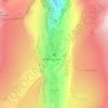
Le Mont topographic map

Click on the map to display elevation.

About this map

Name: Le Mont topographic map, elevation, terrain.

Location: Le Mont, Sixt-Fer-à-Cheval, Bonneville, Haute-Savoie, Auvergne-Rhône-Alpes, France métropolitaine, 74740, France (46.04138 6.73827 46.08138 6.77827)

Average elevation: 3,599 ft

Minimum elevation: 2,306 ft

Maximum elevation: 7,103 ft

Other topographic maps

Click on a map to view its topography, its elevation and its terrain.
Gear up for your next adventure:

🎒Hydration Pack - Hands‑free water reservoir for long hikes
☀️Outdoor Sunscreen - High protection sunscreen for outdoor activities
🥤Water Filter Bottle - All‑in‑one filter bottle for safe hydration
🪶Compact Camp Shovel - Folding shovel for campsite tasks
🔭Compact Binoculars - HD vision for scouting terrain and identifying distant landmarks

As an Amazon Associate, this site earns from qualifying purchases at no extra cost to you.