Geolocate

Hamilton topographic map

Click on the map to display elevation.

About this map

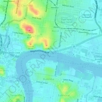
Name: Hamilton topographic map, elevation, terrain.

Location: Hamilton, Brisbane City, Queensland, Australia (-27.44774 153.04719 -27.43115 153.09000)

Average elevation: 49 ft

Minimum elevation: -10 ft

Maximum elevation: 249 ft

Other topographic maps

Click on a map to view its topography, its elevation and its terrain.

Teneriffe

Australia > Queensland > Brisbane City

Average elevation: 36 ft

Constitution Hill

Australia > Queensland > Brisbane City

Average elevation: 472 ft

Gear up for your next adventure:

🩳Quick‑Dry Hiking Shorts - Comfortable and quick‑dry shorts for summer hiking
📌Outdoor GPS Map App - Apps and devices for digital topographic navigation
🏥Hiking First Aid Kits - Comprehensive medical kits for remote trail injuries
📚Navigation Handbooks - Master the art of reading topographic maps and using a compass
🌡️Handheld Weather Meters - Measure wind, temp, and pressure for safe mountain travel

As an Amazon Associate, this site earns from qualifying purchases at no extra cost to you.