Geolocate

Pushkar topographic map

Click on the map to display elevation.

About this map

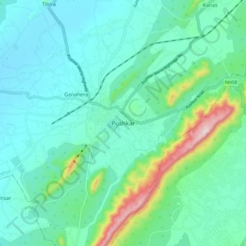
Name: Pushkar topographic map, elevation, terrain.

Location: Pushkar, Pushkar Tehsil, Ajmer, Rajasthan, 305022, India (26.44765 74.51785 26.52765 74.59785)

Average elevation: 1,693 ft

Minimum elevation: 1,404 ft

Maximum elevation: 2,894 ft

Gear up for your next adventure:

🧭GPS Watch Accessories - Bands and chargers for GPS watches
🪑Portable Camp Table - Compact table for campsite meals
🥩Freeze-Dried Meals - Nutritious and lightweight food for remote expeditions
🧭Outdoor Navigation Book - Learn advanced navigation skills
🪓Survival Multi‑Tool - Versatile tool for camp and trail tasks

As an Amazon Associate, this site earns from qualifying purchases at no extra cost to you.