Geolocate

Findlay topographic map

Click on the map to display elevation.

About this map

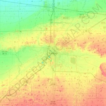
Name: Findlay topographic map, elevation, terrain.

Location: Findlay, Hancock County, Ohio, 45840, United States (40.88139 -83.81040 41.20139 -83.49040)

Average elevation: 797 ft

Minimum elevation: 696 ft

Maximum elevation: 915 ft

Hancock County trails, hiking, mountain biking, running and outdoor activities

Gear up for your next adventure:

📦Gear Storage Bags - Organize and protect outdoor equipment
🧭GPS Watch Accessories - Bands and chargers for GPS watches
🎒Waterproof Dry Bags - Keep your electronics and maps dry inside your pack
👟Men's Trail Runners - Lightweight footwear for fast-paced exploration and light hiking
🌡️Portable Weather Meter - Track weather conditions on the trail

As an Amazon Associate, this site earns from qualifying purchases at no extra cost to you.