
Make a donation
Gear up for your next adventure:
As an Amazon Associate, this site earns from qualifying purchases at no extra cost to you.
Wusterhausen/Dosse topographic map
Click on the map to display elevation.
Make a donation
Gear up for your next adventure:
As an Amazon Associate, this site earns from qualifying purchases at no extra cost to you.
Wusterhausen/Dosse
Das Hospital Zum heiligen Geist (heute Seniorenheim) in der Borchertstraße auf Höhe des Wildberger Stadttors wurde 1307 zum ersten Mal erwähnt. Markgraf Waldemar von Brandenburg hielt sich 1317 in der Stadt auf und verpfändete die Stadt mit acht umliegenden Dörfern an die Grafen von Lindow-Ruppin. Diese übertrugen 1325 der Stadt die obere und niedere Gerichtsbarkeit.
Make a donation
Gear up for your next adventure:
As an Amazon Associate, this site earns from qualifying purchases at no extra cost to you.
About this map
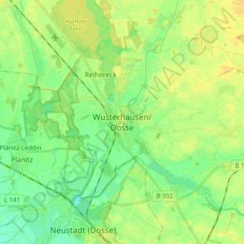
Name: Wusterhausen/Dosse topographic map, elevation, terrain.
Average elevation: 125 ft
Minimum elevation: 89 ft
Maximum elevation: 157 ft
Make a donation
Gear up for your next adventure:
As an Amazon Associate, this site earns from qualifying purchases at no extra cost to you.