
Thank you for supporting this site ❤️
Make a donation
Make a donation
Gear up for your next adventure:
As an Amazon Associate, this site earns from qualifying purchases at no extra cost to you.
Wapakoneta topographic map
Click on the map to display elevation.
Thank you for supporting this site ❤️
Make a donation
Make a donation
Gear up for your next adventure:
As an Amazon Associate, this site earns from qualifying purchases at no extra cost to you.
About this map
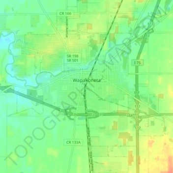
Name: Wapakoneta topographic map, elevation, terrain.
Location: Wapakoneta, Auglaize County, Ohio, 45895, United States (40.53479 -84.23108 40.59625 -84.15688)
Average elevation: 909 ft
Minimum elevation: 856 ft
Maximum elevation: 988 ft
Auglaize County trails, hiking, mountain biking, running and outdoor activities
Thank you for supporting this site ❤️
Make a donation
Make a donation
Gear up for your next adventure:
As an Amazon Associate, this site earns from qualifying purchases at no extra cost to you.