
Thank you for supporting this site ❤️
Make a donation
Make a donation
Gear up for your next adventure:
As an Amazon Associate, this site earns from qualifying purchases at no extra cost to you.
Buwujja-mbeya topographic map
Click on the map to display elevation.
Thank you for supporting this site ❤️
Make a donation
Make a donation
Gear up for your next adventure:
As an Amazon Associate, this site earns from qualifying purchases at no extra cost to you.
About this map
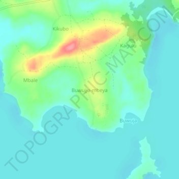
Name: Buwujja-mbeya topographic map, elevation, terrain.
Location: Buwujja-mbeya, Mukono, Central Region, Uganda (0.10346 32.75466 0.14346 32.79466)
Average elevation: 3,770 ft
Minimum elevation: 3,698 ft
Maximum elevation: 3,999 ft
Thank you for supporting this site ❤️
Make a donation
Make a donation
Gear up for your next adventure:
As an Amazon Associate, this site earns from qualifying purchases at no extra cost to you.