
Thank you for supporting this site ❤️
Make a donation
Make a donation
Gear up for your next adventure:
As an Amazon Associate, this site earns from qualifying purchases at no extra cost to you.
Maitínez topographic map
Click on the map to display elevation.
Thank you for supporting this site ❤️
Make a donation
Make a donation
Gear up for your next adventure:
As an Amazon Associate, this site earns from qualifying purchases at no extra cost to you.
About this map
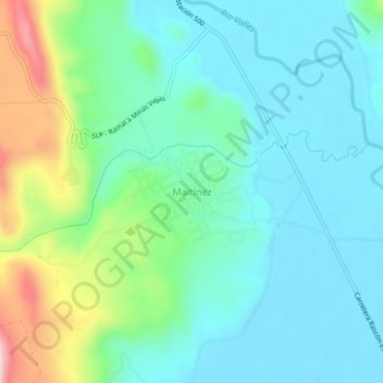
Name: Maitínez topographic map, elevation, terrain.
Location: Maitínez, El Naranjo, San Luis Potosi, Mexico (22.35282 -99.31300 22.39282 -99.27300)
Average elevation: 1,020 ft
Minimum elevation: 794 ft
Maximum elevation: 1,732 ft
Thank you for supporting this site ❤️
Make a donation
Make a donation
Gear up for your next adventure:
As an Amazon Associate, this site earns from qualifying purchases at no extra cost to you.