
Thank you for supporting this site ❤️
Make a donation
Make a donation
Gear up for your next adventure:
As an Amazon Associate, this site earns from qualifying purchases at no extra cost to you.
Somaén topographic map
Click on the map to display elevation.
Thank you for supporting this site ❤️
Make a donation
Make a donation
Gear up for your next adventure:
As an Amazon Associate, this site earns from qualifying purchases at no extra cost to you.
About this map
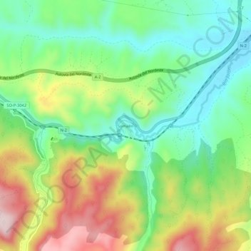
Name: Somaén topographic map, elevation, terrain.
Location: Somaén, Arcos de Jalón, Soria, Castile and León, 42250, Spain (41.17353 -2.33531 41.21353 -2.29531)
Average elevation: 3,143 ft
Minimum elevation: 2,703 ft
Maximum elevation: 3,855 ft
Thank you for supporting this site ❤️
Make a donation
Make a donation
Gear up for your next adventure:
As an Amazon Associate, this site earns from qualifying purchases at no extra cost to you.