
Thank you for supporting this site ❤️
Make a donation
Make a donation
Gear up for your next adventure:
As an Amazon Associate, this site earns from qualifying purchases at no extra cost to you.
Teliseri topographic map
Click on the map to display elevation.
Thank you for supporting this site ❤️
Make a donation
Make a donation
Gear up for your next adventure:
As an Amazon Associate, this site earns from qualifying purchases at no extra cost to you.
About this map
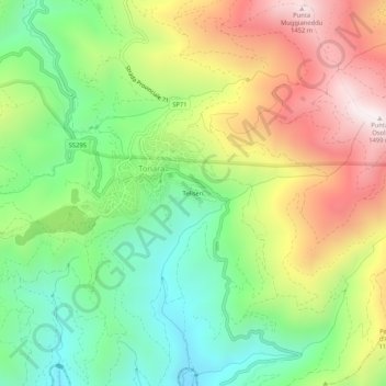
Name: Teliseri topographic map, elevation, terrain.
Location: Teliseri, Tonara, Nuoro, Sardegna, 08039, Italia (40.00257 9.15876 40.04257 9.19876)
Average elevation: 3,130 ft
Minimum elevation: 1,847 ft
Maximum elevation: 4,888 ft
Thank you for supporting this site ❤️
Make a donation
Make a donation
Gear up for your next adventure:
As an Amazon Associate, this site earns from qualifying purchases at no extra cost to you.