
Make a donation
Gear up for your next adventure:
As an Amazon Associate, this site earns from qualifying purchases at no extra cost to you.
La Pontica topographic map
Click on the map to display elevation.
Make a donation
Gear up for your next adventure:
As an Amazon Associate, this site earns from qualifying purchases at no extra cost to you.
About this map
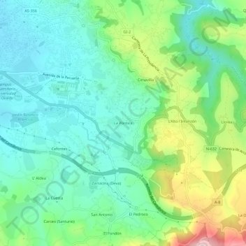
Name: La Pontica topographic map, elevation, terrain.
Location: La Pontica, Gijón, Asturias, 33394, España (43.49896 -5.62135 43.53896 -5.58135)
Average elevation: 276 ft
Minimum elevation: 20 ft
Maximum elevation: 909 ft
Make a donation
Gear up for your next adventure:
As an Amazon Associate, this site earns from qualifying purchases at no extra cost to you.
Other topographic maps
Click on a map to view its topography, its elevation and its terrain.
Huerces
Limita al sur con Siero, sirviendo de divisoria el pico de San Martín, de 519 metros de altitud. Hasta los años 1990 era una área muy poco poblada que vivía básicamente de la agricultura y la cercana mina de La Camocha. Desde la última década del siglo XX pasó a ser una zona residencial de Gijón…
Average elevation: 666 ft
Make a donation
Gear up for your next adventure:
As an Amazon Associate, this site earns from qualifying purchases at no extra cost to you.