
Thank you for supporting this site ❤️
Make a donation
Make a donation
Gear up for your next adventure:
As an Amazon Associate, this site earns from qualifying purchases at no extra cost to you.
Texas topographic map
Click on the map to display elevation.
Thank you for supporting this site ❤️
Make a donation
Make a donation
Gear up for your next adventure:
As an Amazon Associate, this site earns from qualifying purchases at no extra cost to you.
About this map
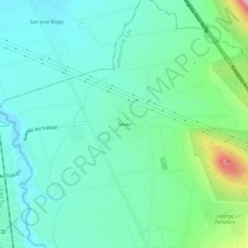
Name: Texas topographic map, elevation, terrain.
Location: Texas, Atotonilco de Tula, Hidalgo, 42980, México (20.00611 -99.21611 20.04611 -99.17611)
Average elevation: 7,123 ft
Minimum elevation: 6,919 ft
Maximum elevation: 7,828 ft
Thank you for supporting this site ❤️
Make a donation
Make a donation
Gear up for your next adventure:
As an Amazon Associate, this site earns from qualifying purchases at no extra cost to you.